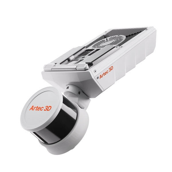
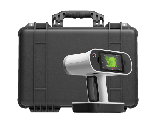
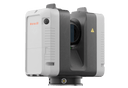
Artec Ray II Premium Pack
Ceny jsou bez DPH a bez sales tax. Doprava se vypočítá při placení.
Key specs
All tech specs- AccuracyHow close each measured point is to its true position. Smaller is better.
- 1.9 mm @ 10 m
- RangeThe nearest and farthest surfaces the scanner can measure.
- Up to 130 m
- SpeedHow many 3D points the scanner records per second. Higher means shorter scanning sessions.
- Up to 2 mln points/s
- Field of viewThe area captured in a single frame, or all around the scanner for 360° devices. Larger covers objects faster.
- 360° × 300°
Dostupné také jako
- Official Artec 3D store — full manufacturer warranty
- Shipping to all EU countries and the US
- Expert support before and after purchase
What's in the pack
- Artec Ray II LiDAR scanner
- Carbon tripod: light, rigid and quick to set up
- Artec Travel Backpack for Ray II
- Artec Studio license for 5 years
- Warranty extended from 1 to 2 years
Why choose the pack
- Ready for the first site visit. Tripod and transport arrive with the scanner, so nothing is missing on day one.
- Five years of software. Process and merge scans, combine them with Leo data and export to CAD, with every new Artec Studio release included.
- Twice the warranty of Ray II on its own.
- Best for surveying, AEC, plant and infrastructure teams starting with Ray II. If you already have Ray II accessories and an Artec Studio license, the scanner alone may be enough.
About Artec Ray II
Artec Ray II is a long-range LiDAR scanner that captures buildings, aircraft, factory floors and crime scenes from 0.5 to 130 m away, with 1.9 mm accuracy at 10 m. It aligns every scan on the spot.
Why Artec Ray II
- Range and precision in one. 18-arcsecond angular accuracy, a 360° × 300° field of view and up to 2 million points/s.
- Pre-aligned, target-free. A visual inertial system registers each position in real time, so you place no targets and scans arrive in Artec Studio already aligned.
- No laptop on site. Run it from the built-in touchscreen or from the Artec Remote app on your phone.
- Photorealistic color. A 36 MP three-camera system with automatic HDR captures calibrated 360° imagery.
- Built for the field. IP54 protection, hot-swappable batteries, Double Scan to remove passers-by, and a targetless Check & Adjust self-test.
Where it shines
Ray II captures whole buildings, plants and large vehicles accurately and fast, from up to 130 m away and with no targets.
- As-built documentation. Buildings, plants and factory floors captured for renovation, BIM and retrofit design, replacing weeks of manual measuring.
- Large engineering objects. Cars, trucks, aircraft, ships and heavy machinery digitized for reverse engineering, inspection and aerodynamic (CFD) analysis.
- Infrastructure inspection. Bridges, floodwalls and railways checked for deformation and damage, with data ready for analysis the same day.
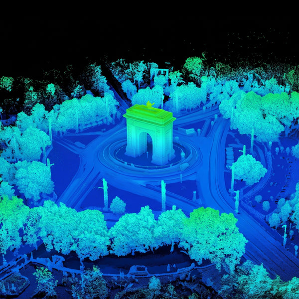
- Heritage, forensics and digital twins. Monuments, crime and accident scenes, and full-size products for virtual showrooms, captured in calibrated color.
Pair it with Artec Leo for close-up detail and merge everything in Artec Studio.
What customers report
- A multi-level historic theater documented as-built in 5 hours from 40 positions, replacing months of manual measuring.
- A section of concrete floodwall scanned in 20 minutes and turned into an inspection-ready mesh in 90 minutes instead of two days.
- A long-haul truck digitized for CFD analysis, which identified 76 kW of drag losses and pointed to changes to the mirrors and roof.
- Industrial machines weighing 5–30 tons digitized full-size for VR trade shows in three countries, without shipping a single unit.
Accuracy & resolution
| 3D point accuracy | 1.9 mm @ 10 m; 2.9 mm @ 20 m; 5.3 mm @ 40 m |
|---|---|
| Angular accuracy | 18 arcseconds (0.87 mm @ 10 m) |
| Range accuracy | 1.0 mm + 10 ppm |
| Resolution | 3 user selectable settings: 3 / 6 / 12 mm @ 10 m |
| Range noise (at 89% albedo, single-shot measurements) | 0.4 mm @ 10 m; 0.5 mm @ 20 m |
Field of view & range
| Field of view | 360° (horizontal) × 300° (vertical) |
|---|---|
| Range | 0.5 – 130 m |
Speed
| 3D capture rate | Up to 2,000,000 points/second |
|---|---|
| Scanning time without texture @ 10 m | 1 min 42 sec @ 3 mm resolution; 51 sec @ 6 mm resolution; 26 sec @ 12 mm resolution |
| Scanning time with texture @ 10 m | 2 min 42 sec @ 3 mm resolution; 1 min 51 sec @ 6 mm resolution; 1 min 26 sec @ 12 mm resolution |
Color capture
| Camera | 36 MP 3-camera system captures 432 MPx raw data for calibrated 360° × 300° spherical image |
|---|---|
| HDR | Automatic, 5 brackets |
Operation
| On scanner | Touchscreen control with finger touch, full-color WVGA graphic display 480 × 800 pixels |
|---|---|
| Mobile devices | Artec Remote app for iOS and Android tablets and smartphones including: remote control of scan functions, settings selection, launch scanning |
Algorithms
| Real time registration | Automatic point cloud alignment based on real time tracking of scanner movement between setups based on Visual Inertial System (VIS) by video-enhanced inertial measurement unit |
|---|---|
| Automatic removal of moving objects | Delete captured data of moving objects using Double Scan |
| Check & Adjust | Field procedure for targetless checking of angular parameters |
Navigation sensors
| Visual inertial systems | Video-enhanced inertial measuring system to track movement of the scanner position relative to the previous setup in real time |
|---|---|
| Tilt | IMU-based |
| Accuracy | 18 arcseconds (for upright and upside down setups with +/- 10° inclination) |
| Geolocation sensors | Altimeter, Compass, Global Navigation Satellite System |
Interfaces
| Wireless | Integrated wireless LAN (802.11 b/g/n) |
|---|---|
| Data storage | AS256, 256 GB exchangeable USB 3.0 flash drive |
Hardware specifications
| Scanning technology | Time of flight enhanced by Waveform Digitizing (WFD) technology |
|---|---|
| Laser class | 1 (in accordance with IEC 60825-1:2014), 1550 nm (invisible) |
| Dimensions | 120 × 240 × 230 mm |
| Weight | 5.35 kg (nominal, without batteries) |
| Mounting mechanism | Quick mounting on 5/8" stub on a lightweight carbon tripod or tripod adapter |
Power
| Internal battery | 2 × AEB364 internal, rechargeable Li-Ion batteries |
|---|---|
| Duration | Typically up to 4 hours |
| Weight | 340 gr. per battery |
| External | GEV282 AC adapter |
Environmental
| Operating temperature | -5°C to +40°C |
|---|---|
| Storage temperature | -40° to +70°C |
| Operating low temperatures | -10° to +40°C* |
| Dust/Humidity | Solid particle/liquid ingress protection IP54 (IEC 60529) (for upright and upside down setups with a +/- 15° inclination) |
* Extended low temperature operation is possible to -10°C if internal temperature is at or above -5°C when powered on. For extended low-temperature measurement, it is recommended that QA procedures are followed.
Real scans, not renders
Plant piping, a semi-trailer truck, a helicopter, a church façade and a crime scene: large objects and whole scenes captured from a tripod with millimeter detail.

Pipe network
48 scans from three heights untangle a dense web of overlapping pipes.
Want to see how it handles your own parts?
Accessories for Artec Ray II Premium Pack
Accessories that are not already included in the pack.


Recenze zákazníků
Zatím žádné recenze — podělte se o svou zkušenost jako první.