LiDAR Scanners

LiDAR 3D scanners for buildings, plants, mines and infrastructure: terrestrial Ray II for millimeter accuracy, mobile SLAM Jet for whole sites in minutes.

3 produkty
Sortuj według
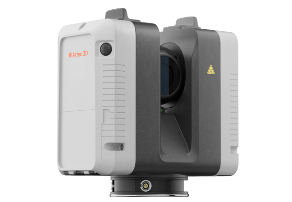
Artec Ray II long-range LiDAR 3D scanner
Artec 3D

Artec Ray II

★★★★★5.0 (2)
59 450 €
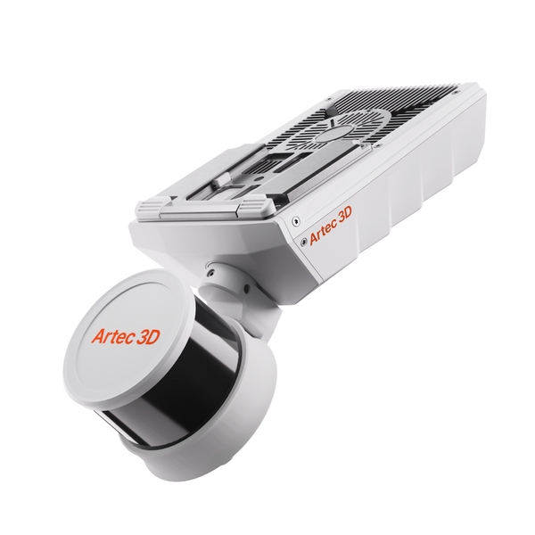
NewArtec Jet SLAM LiDAR mobile mapping scanner
Artec 3D

Artec Jet

38 500 €
Artec Ray II Premium Pack
Artec 3D

Artec Ray II Premium Pack

68 650 €
Choose by method

Terrestrial or mobile LiDAR

Ray II gives maximum accuracy from fixed positions. Jet covers entire sites while you walk, drive or fly. Both merge in Artec Twins.

0.5–130 m

Terrestrial LiDAR on a tripod

As-built interiors, facades, plant rooms, aircraft, accident scenes
Artec Ray II€59,450
  • 1.9 mm at 10 m, 18-arcsecond angular accuracy
  • 36 MP three-camera HDR color
  • IP54, runs from touchscreen or phone

Also consider Artec Studio Pro — processes Ray II scans; five years in the Premium Pack

0.5–300 m

Mobile SLAM LiDAR

Mines, tunnels, plants, stockpiles, venues: handheld, vehicle or drone

Artec Jet€38,500
  • ±10 mm indoor and underground, ±5 mm change detection
  • Seven deployment modes, one device
  • IP65, works in darkness without GPS

Also consider Artec Twins — drift removal, georeferencing and change detection for Jet data

From LiDAR capture to digital twin

Combine mobile and terrestrial data in one georeferenced model in Artec Twins.

Artec Twins
  1. Map the whole site

    Walk, drive or fly Jet through the site. A live point cloud in the companion app confirms coverage, even in the dark and without GPS.

  2. Add precision where needed

    Set up Ray II on facades, plant rooms or key structures: 1.9 mm at 10 m, with every position pre-aligned on site.

  3. Merge and georeference

    Artec Twins removes drift, georeferences with ground control points and aligns Jet, Ray II and Leo data into one dataset.

  4. Measure and deliver

    Take volumes, sections and change detection, compare with CAD, then export LAS, LAZ or E57 point clouds or go to BIM.

Real scan data

Real LiDAR datasets

Plant piping and a regulating station scanned from a tripod, plus a workshop, power lines, a tunnel and a car park mapped on the move.

Pipe network
Pipe network

Pipe network

48 scans from three heights untangle a dense web of overlapping pipes.

Scanned with
Artec Ray II
Scan time
5 h
Processing
3 h

Results from LiDAR projects

90min

Part of a 25-foot concrete floodwall under a vibrating overpass was captured by Ray II from 9 positions in 20 minutes, with Leo adding detail on rusty doors.

Scanned withArtec Ray II

3×

A dark, GPS-denied facility was mapped inside and out in under 45 minutes for volume measurement and compliance. Jet flew the interior by drone in 15 minutes.

Scanned withArtec Jet

30min

Jet mapped a crowded 16th-century shrine from a backpack without disturbing worshippers, and Ray II added facade carvings at 1.9 mm accuracy. Processing took 2 hours.

Scanned withArtec Jet

How much does a LiDAR scanner cost?

In our store, Artec Ray II is 59 450 € and Artec Jet is 38 500 €. The Ray II Premium Pack, 68 650 €, adds a carbon tripod, a travel backpack, a 5-year Artec Studio license and a warranty extended from 1 to 2 years. Jet comes with a 2-year manufacturer warranty.

When comparing prices, count the whole setup: processing software (Artec Studio for Ray II, Artec Twins for Jet data), a tripod for Ray II, and for Jet any drone, sold separately, or the optional action camera kit for true-color point clouds. A demo with an Artec 3D expert shows which setup your sites need.

Questions about LiDAR 3D scanners

Terrestrial or mobile LiDAR: which do I need?

Terrestrial Ray II gives the highest accuracy in focused areas, 1.9 mm at 10 m. Mobile Jet gives speed and full-site coverage at ±10 mm indoors and underground. The two datasets merge in Artec Twins.

How fast is capture?

Ray II captures up to 2 million points/s and scans a full dome at 3 mm resolution (at 10 m) in 1 min 42 s without texture. Jet captures up to 1.92 million points/s while you walk, or drive at up to 60 km/h.

Does LiDAR work in the dark or without GPS?

Jet does: its active laser needs no ambient light, and SLAM positioning keeps mapping in GPS-denied mines and tunnels, continuing seamlessly from GNSS areas. Ray II registers each position with its visual inertial system, with no targets.

Are the lasers eye-safe?

Yes. Both Ray II, with its invisible 1550 nm laser, and Jet use Class 1 lasers.

What file formats do I get?

Jet delivers LAS, LAZ, PLY and E57 point clouds plus a trajectory file, and Artec Twins adds DXF export. Ray II data is processed in Artec Studio for scan-to-CAD, or sent to Geomagic Control X for inspection reports.

Which software processes LiDAR data?

Artec Twins processes, georeferences, merges and analyzes Jet, Ray II and Leo data, rendering multi-billion-point datasets in real time. Ray II scans also open in Artec Studio.

Is there a handheld LiDAR scanner?

Yes. Artec Jet weighs 1.57 kg and works handheld or on a backpack, pole, cage, vehicle, robot or drone. Ray II stands on a tripod but is built for the field: IP54, hot-swappable batteries and control from its touchscreen or the Artec Remote app, with no laptop on site.

Can I scan from a drone?

Yes, with Artec Jet on a supported drone, sold separately. AI-assisted flight with 360° collision avoidance detects wires down to 2 mm, and waypoint missions with a return-to-base failsafe cover collapsed, flooded or hazardous areas without sending people in.

Planning a LiDAR survey?

See terrestrial and mobile LiDAR on sites like yours

Book a live demo with an Artec 3D expert. Bring your questions about accuracy, coverage, georeferencing and deliverables.