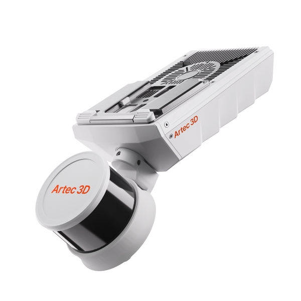
Handheld SLAM LiDAR Scanner

Mobile SLAM LiDAR mapping with Artec Jet: capture mines, tunnels, plants and venues while you walk, drive or fly, even in darkness and without GPS.

1 produkt
Sortuj według
NewArtec Jet SLAM LiDAR mobile mapping scanner
Artec 3D

Artec Jet

38 500 €
Who it is for

One mapper, seven ways to deploy

Jet suits teams that survey whole sites fast, including places where no tripod, and no person, should go.

0.5–300 m

Sites, mines and facilities

Mines, tunnels, plants, stockpiles, stadiums, heritage sites, disaster scenes

Artec Jet38 500 €
  • ±10 mm indoor and underground, ±0.03% drift
  • Handheld, backpack, pole, cage, vehicle, robot, drone
  • IP65, 1.57 kg, works in darkness

Also consider Artec Twins — processes, georeferences and merges Jet data with Ray II and Leo
From walk-through to survey deliverable

One device in the field, one software for processing and analysis.

Artec Twins
  1. Choose the mount

    Handheld, backpack, pole, cage, vehicle up to 60 km/h, robot or drone: Jet moves between them with a quick-release mount.

  2. Capture on the move

    Start and stop while walking or hovering. A live point cloud in the companion app confirms coverage before you leave the site.

  3. Process in Artec Twins

    Remove drift, georeference with ground control points or RTK, and merge sessions with Ray II and Leo scans into one dataset.

  4. Analyze and export

    Measure volumes, run change detection down to ±5 mm, take sections and export LAS, LAZ, PLY or E57, or go to BIM.

Real scan data

Real Jet datasets

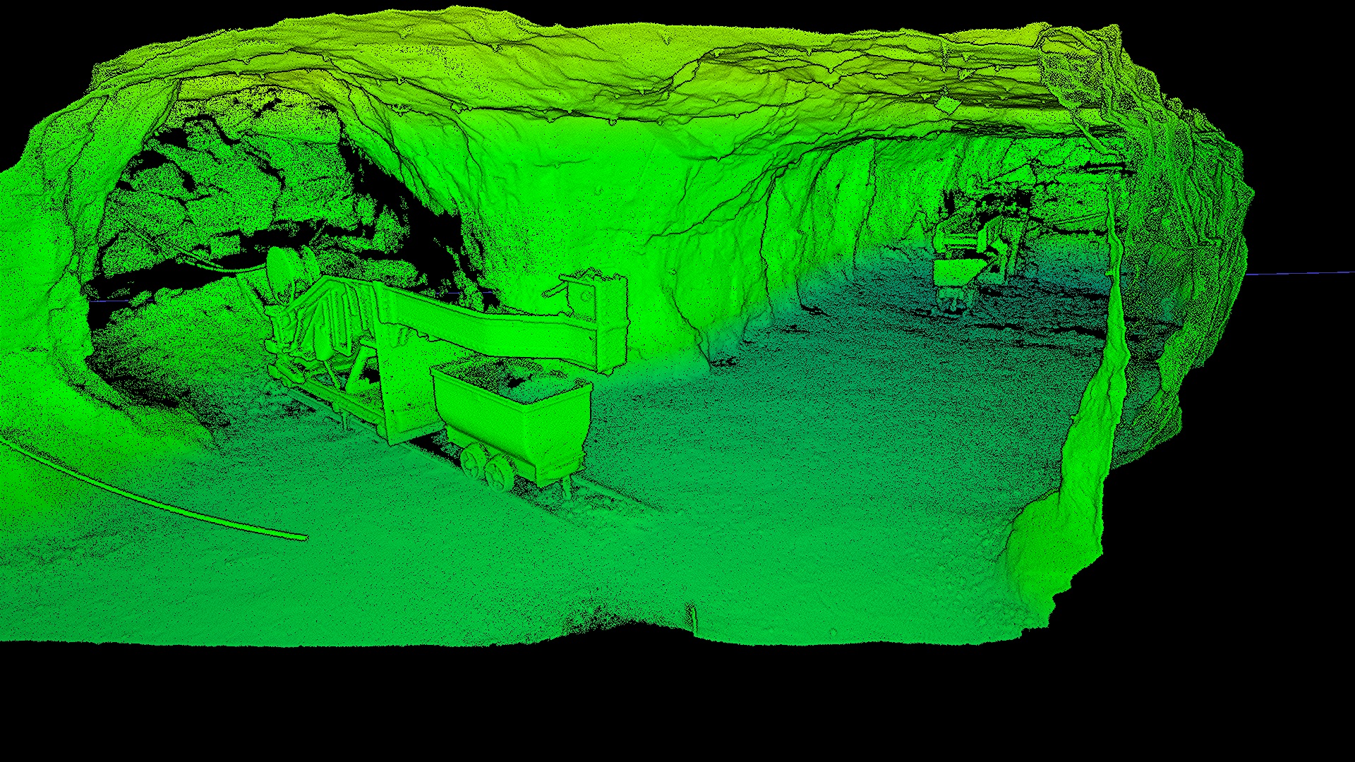
A mine, a tunnel, a car park, an ice rink roof, a concert hall and fort ruins: GPS-denied and hard-to-reach spaces, mapped in minutes. Play any flythrough.

Underground iron mine
Handheld, underground

Underground iron mine

Dark, dusty tunnels with no GPS, mapped on foot.

Scanned with
Artec Jet + Artec Twins
Scan time
26 min

Results from Jet mapping projects

9ha

A flooded, GPS-denied mine was mapped autonomously without risking personnel. Change detection revealed pillar weakening and water ingress, and the operator bought its own unit for routine monitoring.

Scanned withArtec Jet

3×

Drone indoors, on foot underground: a dark, GPS-denied facility was mapped inside and out in under 45 minutes, with no tripod to reposition.

Scanned withArtec Jet

30min

From a backpack and a vehicle, Jet kept tracking at driving speed among moving staff and sprinklers. Capture is short enough to fit between games.

Scanned withArtec Jet

One device, seven ways to deploy

A quick-release mount moves Jet between handheld, backpack, pole, cage, vehicle, robot and drone use, so one device covers very different sites. In the Jet datasets on this page, an iron mine was mapped handheld underground, a concert hall from a backpack, a car park by vehicle and on foot, and an ice rink roof by drone indoors.

Jet is rated IP65, weighs 1.57 kg, operates from −10 to 45 °C and stores data on 512 GB of onboard memory. Vehicle mapping runs at up to 60 km/h. On a drone, sold separately, AI-assisted waypoint missions cover collapsed, flooded or hazardous areas where no person should go.

How much does a handheld LiDAR scanner cost?

In our store, Artec Jet is 38 500 €, with a 2-year manufacturer warranty, and that one device covers all seven deployment modes. Drones are sold separately, and true-color point clouds need the optional action camera kit.

Budget for processing too. Artec Twins, sold as a yearly plan or a lifetime license, removes drift, georeferences, detects change and exports LAS, LAZ, PLY, E57 or DXF, with all processing on your own PC. Book a demo to see Jet and Artec Twins on data from a site like yours.

Questions about SLAM 3D scanning

What is SLAM mapping?

SLAM (simultaneous localization and mapping) lets Jet work out its own position from its LiDAR data as it moves, so it maps without tripod setups, targets or GPS. Drift is rated at ±0.03%.

How accurate is Jet?

±10 mm indoors and underground, ±15 mm in general environments and ±5 mm for change detection. Actual accuracy depends on site geometry, loop closures and the use of ground control points or RTK.

SLAM or terrestrial scanning?

Jet gives speed and full-site coverage; terrestrial Artec Ray II gives maximum accuracy in focused areas. Their data can be merged in Artec Twins.

Can Jet fly on a drone?

Yes, on supported drones, sold separately. AI autonomy flies waypoint missions, avoids obstacles in 360° down to 2 mm wires and returns to base on low battery or excessive dust.

Does Jet capture color?

Jet records intensity by default, and many applications don’t need color. For true-color point clouds, add the optional action camera kit; Artec Twins aligns the images automatically.

How much training does it take?

Very little. Jet is plug-and-play with push-button operation, and most users are productive after a short introduction session.

Can Jet be carried on a backpack?

Yes. The backpack is one of its seven deployment modes, alongside handheld, pole, cage, vehicle, robot and drone, and lets you map interiors, venues and sites at walking pace.

Can Jet data be georeferenced for surveying?

Yes. Artec Twins georeferences Jet data with ground control points, and Jet supports GNSS/RTK accessories, continuing seamlessly from GNSS areas into GPS-denied zones. Our surveying page covers the full workflow.

Mapping a site or a mine?

See Artec Jet mapping on sites like yours

Book a live demo with an Artec 3D expert. Bring your questions about deployment modes, accuracy, georeferencing and Artec Twins.