3D Scanners for Surveying

Mobile and terrestrial LiDAR scanners for survey-grade site capture: map mines, tunnels, plants and infrastructure in minutes, even underground and without GPS.

3 prodotti
Ordina per
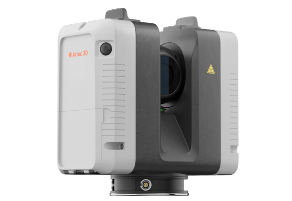
Artec Ray II long-range LiDAR 3D scanner
Artec 3D

Artec Ray II

★★★★★5.0 (2)
59.450 €
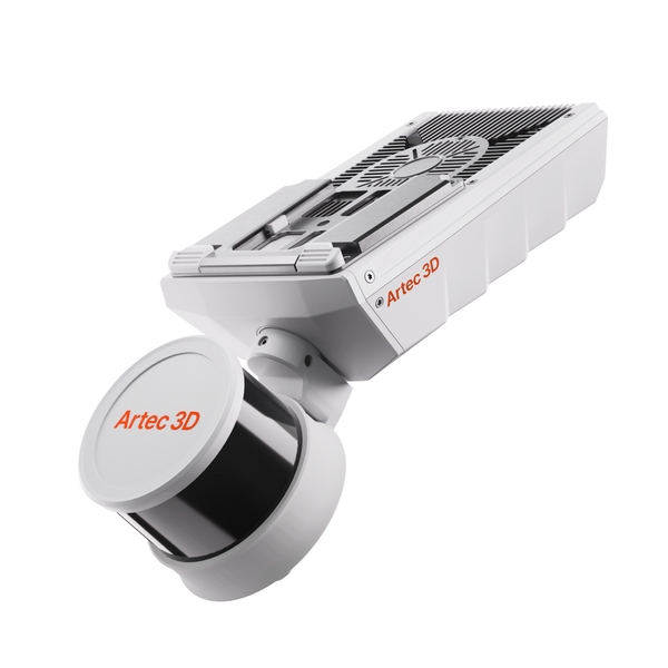
NewArtec Jet SLAM LiDAR mobile mapping scanner
Artec 3D

Artec Jet

38.500 €
Artec Ray II Premium Pack
Artec 3D

Artec Ray II Premium Pack

68.650 €
Choose by job

Mobile mapping or terrestrial precision

Jet covers whole sites at walking, driving or flying speed. Ray II adds tripod precision in focused areas. Both merge in Artec Twins.

Whole sites, any terrain

Mobile SLAM mapping

Mines, tunnels, stockpiles, corridors and disaster sites, on foot, vehicle or drone

Artec Jet38.500 €
  • ±10 mm underground, ±5 mm change detection
  • Vehicle up to 60 km/h, drone, backpack or cage
  • IP65, works in darkness without GPS

Also consider Artec Twins — volumes, change detection and georeferencing
Up to 130 m per station

Terrestrial precision scanning

Bridges, floodwalls, facades and structures checked for deformation and damage

Artec Ray II59.450 €
  • 1.9 mm at 10 m, range accuracy 1.0 mm + 10 ppm
  • Altimeter, compass and GNSS on board
  • IP54, hot-swappable batteries

From field to deliverable

Capture, georeference and analyze in one workflow, from a single station to a whole mine.

Artec Twins
  1. Set control

    Place ground control points or connect GNSS/RTK accessories. Jet continues from GNSS areas into GPS-denied zones in one session.

  2. Capture the site

    Walk, drive or fly Jet through the site, with a live point cloud in the companion app. Set up Ray II where tight accuracy is needed.

  3. Process and georeference

    In Artec Twins, remove drift, detect targets automatically, georeference to control points and merge every run and station.

  4. Analyze and deliver

    Measure volumes, cross-sections and profiles, run change detection down to ±5 mm, and export LAS, LAZ, PLY, E57 or DXF.

Real scan data

Real survey datasets

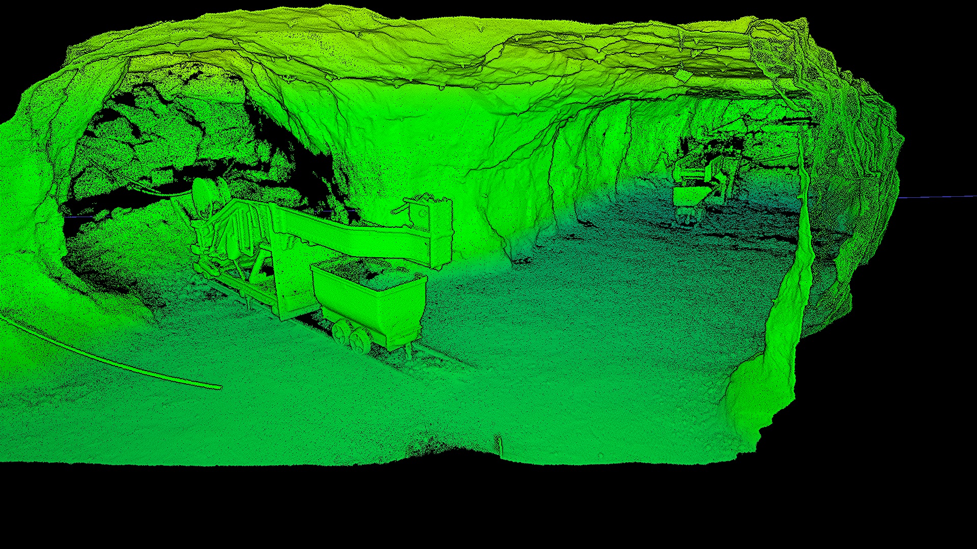
A mine, power lines, a tunnel, a castle and fort ruins: large and GPS-denied sites mapped on foot. Play any flythrough.

Underground iron mine
Underground mine

Underground iron mine

Dark, dusty tunnels with no GPS, mapped on foot.

Scanned with
Artec Jet + Artec Twins
Scan time
26 min

Results from survey projects

48h

A drone-mounted Jet mapped a flooded, GPS-denied collapse zone with no one sent in. Change detection revealed pillar weakening and water ingress.

Scanned withArtec Jet

3×

Waste piles inside a poorly lit, GPS-denied facility were mapped for volume measurement and compliance. The whole site, inside and out, took under 45 minutes.

Scanned withArtec Jet

90min

Part of a 25-foot concrete floodwall under a vibrating overpass was captured with Ray II in 20 minutes from 9 positions to check deformation, corrosion and damage.

Scanned withArtec Ray II

Mobile or terrestrial?

Choose mobile mapping when coverage and time on site matter most: corridors, tunnels, mines, stockpiles and building complexes. Jet works in complete darkness, continues from GNSS areas into GPS-denied zones in one session and flies on a drone where people should not go. Drift is rated at ±0.03%.

Choose tripod stations where tolerances are tight: facades, structures, deformation checks and detailed as-built work. Ray II registers each station on the spot without targets, carries an altimeter, compass and GNSS, and is IP54-rated with hot-swappable batteries. Many surveyors use both and merge the data in Artec Twins.

In our store, Artec Jet is 38.500 € and Artec Ray II is 59.450 €. The Ray II Premium Pack adds a carbon tripod, a travel backpack, five years of Artec Studio and a 2-year warranty.

Questions about 3D scanning for surveying

Is Artec Jet survey-grade?

Jet maps at ±10 mm indoors and underground and ±15 mm in general environments, with ±5 mm change detection and ±0.03% drift. Actual accuracy depends on geometry, loop closures and the use of control points or RTK.

When should I use Ray II instead of Jet?

Jet gives speed and full-site coverage; Ray II gives maximum accuracy in focused areas, with 1.9 mm at 10 m. You can use both and merge the data in Artec Twins.

Does Jet work underground or without GPS?

Yes. SLAM positioning and an active laser work in complete darkness and in GPS-denied spaces such as mines and tunnels.

Can I measure stockpile volumes?

Yes. Artec Twins measures volumes, cross-sections and profiles, and runs change detection between surveys.

What deliverables can I export?

Full-resolution and decimated point clouds plus the trajectory file, as LAS, LAZ, PLY or E57. Artec Twins also exports DXF.

How rugged is the equipment?

Jet is IP65 and works from −10 to 45 °C. Ray II is IP54, works from −5 to +40 °C and runs on hot-swappable batteries.

How do I tie the survey to control?

Place control targets on ground control points, which Artec Twins detects automatically and uses to georeference each survey, or connect GNSS/RTK accessories to Jet. Ray II carries an altimeter, compass and GNSS.

Can I use them for building surveys?

Yes. Ray II records facades, interiors and structures as-built from a tripod, and Jet captures whole buildings and car parks as you walk. Artec Twins then exports the data for scan to BIM.

How long does a survey take on site?

It depends on the site, but capture is fast. Jet mapped a 6,700-seat stadium inside and out in 30 minutes, and Ray II scanned part of a concrete floodwall from 9 positions in 20 minutes, with an inspection-ready mesh in 90 minutes instead of two days.

Not sure which scanner fits?

See your site mapped and processed in Artec Twins

Book a live demo with an Artec 3D expert. Bring your questions about site size, accuracy, control and deliverables.